

An overview of Birr’s streets and squares in 1826

The streets of Birr as described by Cooke precede the Ordnance Survey by twelve years and come five years after the 1821 census of Birr
Thomas Lalor Cooke’s The Picture of Parsonstown in the Kings County containing the history of that town, from the earliest period to the year 1798, together with its description at the present day, was first published in 1826.
in 1929 the Offaly Chronicle office, Birr, published a newly set but incomplete edition. Both issues are long out of print, especially the first edition. A new complete facsimile edition prepared by Birr Historical Society with an introduction by Margaret Hogan will be appearing in early August to mark the 200th anniversary of the first edition. Cooke’s work was the first history of Birr to be published and was in the spirit (if not the grandeur) of Hardiman’s Galway published in 1820.
The Picture was a well-produced book and had nine views of Birr town executed by Cooke and described by him as ‘rude engravings’. In the fashion of epistolary novels of the time Cooke published anonymously, but of course all knew that he was the author.
The best part of the book today may well be the description of the town in 1826 and the little barbed comments in the book about matters passing in Birr such as the fall of Bernard’s bank on the corner of Duke Square with Duke Street which in its ruinous condition Cooke compared to a brothel. His comments on the relationship between Foster the painter and Thomas C. Parsons are thinly veiled.
Cooke’s Streets of Birr in 1826
The streets of Birr as described by Cooke precede the Ordnance Survey by twelve years and come five years after the 1821 census of Birr. It is a useful collection from which we know that Compton’s Row was only recently built as was the entrance gates to the demesne from Oxmantown Mall. Castle Street had already begun its downward trajectory. The market house in Market Square akin to that in Roscrea was long gone – perhaps since 1788. The name Parsonstown was altered by the new urban council back to Birr in 1899. Duke Square went in favour of Emmet Square in 1922, but unlike Tullamore’s wholesale changes in 1905 there were few in Birr. The Duke and Cumberland Street were disposed of in 1922.
In the list below the spelling and style of Mr Cooke have been retained.
Back Lane is parallel to the Main-Street, to the east of which it lies, running from Conaught-Street to the river.
Burkes –Hill leads from Cumberland-Street towards Ballyboy. Off this outlet, towards the river, runs Love-Lane, a pleasant evening walk. Burkes-Hill was formerly called See-Birr-hill.
BURKES-LANE connects the Main-street, and Back-lane.
CASTLE-STREET was once fashionable, and is one the oldest streets in the town. At the junction of this with the Main Street formerly stood the Market and Session-house. The view of Castle-street is terminated to the north-west by the lofty wall of the Castle, over which the high turrets of that building appear with good effect. Here are some shops and comfortable private houses, as also Mr. Robinson’s extensive distillery and brewery.
CHAPEL-LANE lies between Back-Lane and Oxmantown-bridge, and here, as its name imports, stand the old and new Roman Catholic chapels.
CHURCH LANE extends from the Main-street to Castle-street. On the right hand side of this lane is Mr. Coghlans Coach Factory, and a little further up upon the opposite side are the remains of the old church and church-yard. This lane seems to have been originally denominated Brandon-street.
COMPTONS ROW runs from Conaught street to Elmgrove Bridge, and contains several neat houses most of which were lately built by Mr Compton from whom it takes its name.
CONAUGHT – STREET reaches from Church-lane to Comptons-row. In this street is Mr. Nevin’s day-school. And adjoining it are the glebe fields. The Duke Square also communicates with it.
CUMBERLAND SREET Runs from the Duke’s-square to Townsend-street, and exhibits serval good houses. In the space between this street, and Oxmantown Mall stands the new church. Here are also the Court-house, Goal, and Excise-office. This street is entirely inhabited by private individuals, and is the best and most convenient in the town for the residence of a private family.
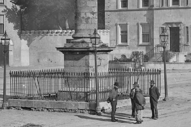
DUKE-SQUARE - This is a pretty square, surrounded with excellent houses, and inhabited by private persons, save the King’s – Arms hotel which lies at its south-east angle. In the centre of the square is a deservedly admired pillar of the Doric order, forty-seven feet high, surmounted by a statue of the Duke of Cumberland, seven feet and a-half high, making together about fifty-four and a half feet. This pillar was erected by subscription in 1747 in commemoration of the memorable battle of Culloden. The Statue that surmounts it was procured and set up at the sole expense of Sir Laurence Parsons, Bart, grandfather of the present Earl of Rosse. It was made by Cheere of London the same artist who executed the monument* in memory of the Earl of Kildare, that stands on the north-side of the Alter in Christ Church, Dublin.
DUKE STREET runs from the square to the Main-street
EDEN EXTENDS FORM THE Entrance to Castle for at least a quarter of a mile on the road towards Banagher.
GALLOWS – HILL adjoins the extremity of Graveyard – street and extends a good way towards Balyloghanane. This probably take its name from a gallowS erected in 1690 by Colonel Oxburgh, then Provost Marshal. The green runs from the Duke-square to the old Castle gate, and contains some snug private houses.
GRAVEYARD STREET is of considerable length leading from the junction of the Main and Moorpark Street to Gallowshill.
THE GREEN runs from Duke Square to the old castle gate and contains some snug private houses.
MAIN – STREET in which are several well assorted shops, extends from Duke - square to the junction of Moorpark-street and Graveyard Street. It seems to have been called High – street in 1628 at which period Duke –street which lies between the present Post –office and the Square appears to have had the name of North –street.
Mead’s Lane runs between the Main Street and Back Lane
MELSOP – STREET and Pound – street lie between Townsend – street and Eden.
MILL –LANE lies to the East of the Main Street, parallel with the river.
MOORPARK – STREET leads from the Main – street towards Seffin. The principal thing to be remarked here is Mr. Hackett’s Distillery.
OXMANTOWN – MALL runs from the church to the new entrance to the Earl of Rosse’s Demesne, and has on its south – side a pleasant walk and terrace overhung with trees. The new entrance to the demesne, which terminates this Mall upon one end, is a handsome building of cut limestone, ornamented with castellated towers, and having an embattled wall running throughout its entire length.
POST –OFFICE-LANE was once the passage to St. Brendan’s well, and lies off Graveyard –street.
SOUTH MALL runs from Oxmantown Bridge to Connaught Street.
SPINNERS – LANE lies between Church- Lane and the Green.
TOWNSEND – STREET runs from Cumberland – street to the extremity of the town, on the Frankford road.
WHITES – ROW lies opposite the Castle wall, and extends from the new Entrance to the demesne, into the Green.
WILLIAM STREET lies between the Green and the Old Church.