

Ireland weather latest: Storm Ciaran's 'rapid development' overnight is bad news for Ireland

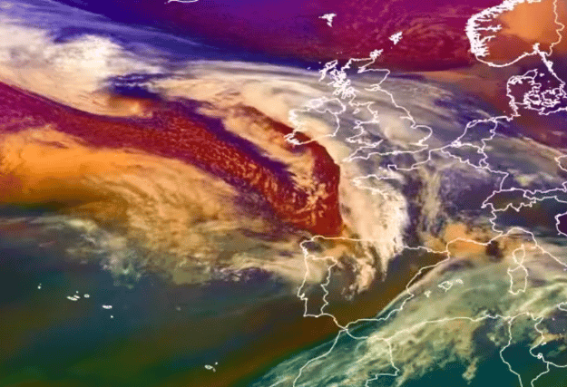

Storm Ciaran looks set to pass a little closer to Ireland than previously thought on Tuesday as new models show the horrid weather system undergoing "rapid development."
That's according to weather expert Alan O'Reilly from Carlow Weather who has been studying the storm since last week.
Alan said "airmass satellite animation from EUMETSAT showing Storm Ciarán undergoing rapid development over the last 12 hours. Latest weather model updates show a little move North which increases risk of over 20mm in parts of South and Southeast."
Conditions are already atrocious in coastal counties with Storm Ciaran still swirling out in the Atlantic.
Alan added that we've already seen "torrential rain in parts of the West with strong winds as system moves North with sunny spells further South. Then we can see Storm Ciarán developing out in the Atlantic as he begins to take shape before passing South of us tonight [Wednesday].
Met Éireann has already issued a series of warning ahead of Storm Ciaran.
The first is a Status Yellow wind warning for Clare, Kerry and Galway that predicts "strong and very gusty westerly winds, accompanied by squally showers."
Possible impacts include "difficult travelling conditions and wave overtopping" in those counties between the hours of the warning from 5am on Wednesday to 11am on Wednesday.
The first warning related directly to Storm Ciaran a Status Yellow rain warning for Carlow, Kilkenny, Wexford, Wicklow, Cork and Waterford.
"Further rainfall associated with Storm Ciarán, combined with saturated ground conditions and high river levels, may lead to flooding," Met Éireann said.
This warning is valid from 7pm on Wednesday to 7am on Thursday. Localised flooding and difficult travelling conditions is likely in the affected counties.